|
FIONA rushes to join Hurricane EARL over Haiti
August 31, 2010 |
News
HaitiAction.net |
||||

 |
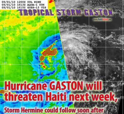 |
| Click image above to open September 1 story |
FIONA rushes to join Hurricane EARL over Haiti
Haiti Action.net - Port au Prince, Haiti — Dare we say this is a "stormy" relationship? In the 100 year reprise of "The Earl and the Girl," with Tropical Storm FIONA substituting for Liza Shoddam, it appears that an elitist comedy of errors provides yet another close call for Haiti. In this remake, it appears that FIONA will follow a cold trail in the EARL's path and get worn out when she tries to rub shoulders with the rich and "mingle."
Had you read the masterful and encyclopedic Maxwell column — Under the Gun September 11, 2004 — you would have known, already, that a hurricane is a heat-seeking cyclone that feeds off of a warm sea surface leaving behind a slightly cooler trail. FIONA is approaching the EARL in that slightly cooler path and is not gaining as much strength as it would have if it followed another path — like closer to the Inter Tropical Convergence Zone (ITCZ) — to the south. The drama of last week is providing another "close call" for Haiti, while the attention of everyone — who isn't living under a tarp or in a tent — is drawn to the "Tragicomedy of Exclusion," which was intended — by design — to be a "distraction."
Since tropical cyclones — in the northern hemisphere — rotate counter-clockwise (admittedly, in the digital age, this is antediluvian description will befuddle the young'ns) struggling Tropical Storm FIONA will be figuratively "kicked in the teeth" by Hurricane EARL strolling up the red carpet whistling "Dixie and slammed up against the western wall of the subtropical ridge." All in all, science doesn't betray elitist fabrication in this independent adaption of the "elements" besieging those who are disconnected with the Monied Class — who are now, suddenly, of the Haitian "Internally Displaced" class.
FIONA is still moving forward at a fairly quick 21mph with a 290º heading, while EARL is moving at 14mph/311º . Last Hurricane Hunter readings showed that the floundering tropical storm FIONA still has some wind left in her soul at 35-40mph in tattered regions. It is expected that FIONA will turn to the right of EARL's path and quickly dissipate in the subtropical region with the additional northerly shear that will finally tear apart this mass of swirling air and thunderstorms.
On the other hand, the interests to the north will be momentarily fixated on Hurricane EARL which has the potential of slamming into the anti-worker state of North Carolina as a Category FOUR hurricane over the Labor Day weekend…
In the 5PM AST Advisories of the National Hurricane Center in Miami state…
LARGE AND INTENSE [is that "intense or "in tents?" Is the EARL really an interloper after all?] HURRICANE EARL CHURNING NORTHWESTWARD OVER THE ATLANTIC...PASSING WELL EAST OF THE TURKS AND CAICOS ISLANDS...
Well… … tell that to the folks in the north of Haiti. On this day in 2008, Tropical Storm Hanna was 225 miles NW — 23.6 N 71.0W — of where Hurricane EARL is now before making a U-turn above the Turks and Caicos Islands and sat just north of Haiti for a few days before returning to the same stroll up the Eastern Seaboard. Tropical cyclones travel where they will. With the close proximity of FIONA, statistical averages become unpredictable, as with most stormy relationships.
The outer rainbands of EARL are glancing over President Preval's home, further saturating the countryside in anticipation of the impending storms of the 2010 Hurricane season. The next tropical wave of note wandering in the ITCZ has been downgraded for a few more days. FIONA could still decide to stop chasing the EARL and take a Caribbean cruise instead. Let's hope that doesn't happen. Stay tuned…
RAW
View the latest observations near HURRICANE EARL
Share this story with your networks
BOOKMARK the Haiti Action.net Tropical Cyclone Page for latest updates during this hurricane season. HaitiAction.net will host this page with many Tropical Cyclone resources so you can find the latest information when you are searching for current updates.
Contact us: info@haitiaction.org
BOOKMARK the Haiti Action.net Tropical Cyclone Page for latest updates during this hurricane season.
000
WTNT43 KNHC 010900
TCDAT3
TROPICAL STORM FIONA DISCUSSION NUMBER 7
NWS TPC/NATIONAL HURRICANE CENTER MIAMI FL AL082010
500 AM AST WED SEP 01 2010
RECONNAISSANCE DATA...RADAR DATA FROM GUADELOUPE...AND SATELLITE
IMAGERY INDICATE FIONA HAS BECOME A LITTLE BETTER ORGANIZED THIS
MORNING. DEEP CONVECTION HAS INCREASED IN THE SOUTHERN SEMICIRCLE
AND THE CENTER HAS BECOME BETTER DEFINED IN RADAR IMAGERY AND IN
FLIGHT-LEVEL WIND DATA. THE MAXIMUM 850 MB FLIGHT-LEVEL WINDS
OBSERVED THUS FAR DURING THE CURRENT MISSION HAS BEEN 52 KT IN THE
NORTHEAST QUADRANT...WHICH EQUATES TO ABOUT A 42-KT SURFACE WIND.
THE LOWEST PRESSURES OBSERVED THUS FAR HAVE BEEN 1002 MB AT 0602Z
AND 1004 MB AT 0803Z. THE INITIAL INTENSITY IS SET AT 40 KT...WHICH
IS LOWER THAN THE 50-KT ADT INTENSITY ESTIMATE FROM UW-CIMSS.
THE INITIAL MOTION IS 290/12 KT USING RECON AND RADAR FIX POSITIONS.
FIONA APPEARS TO HAVE DECREASED ITS RATE OF CLOSURE ON EARL LOCATED
TO ITS NORTHWEST. OVER THE PAST 48 HOURS...THE DISTANCE BETWEEN
FIONA AND EARL HAS BEEN DECREASING BY ABOUT 100 NMI EVERY 12
HOURS...AND THE TWO CYCLONES ARE CURRENTLY ABOUT 750 NMI APART.
RIDDING BETWEEN THE TWO SYSTEMS HAS OBVIOUSLY INCREASED...WHICH HAS
RESULTED IN THE SIGNIFICANT DECREASE IN THE FORWARD SPEED OF FIONA
FROM MORE THAN 20 KT DOWN TO THE CURRENT 12 KT IN THE PAST 12
HOURS. THE POSSIBLE CAUSE OF THE RIDGING TO THE NORTHWEST OF FIONA
IS THE UPPER-LEVEL OUTFLOWS FROM BOTH CYCLONES CONVERGING TO THE
NORTHWEST OF FIONA. THIS RIDGING MAY ALLOW KEEP FIONA FROM
INTERACTING WITH THE LARGER CIRCULATION OF EARL LIKE MOST OF THE
GLOBAL MODELS HAVE BEEN FORECASTING THE PAST COUPLE OF DAYS. ALL OF
THE MODEL GUIDANCE...EXCLUDING NOGAPS...NOW SLOWS DOWN FIONA BY DAY
3...WITH THE CYCLONE POSSIBLY GETTING TRAPPED IN THE SUBTROPICAL
RIDGE. AS RESULT OF THESE NEW SCENARIO...A 96-HOUR POSITION HAS
BEEN ADDED AND DISSIPATION HAS BEEN DELAYED UNTIL 120 HOURS. IF
FIONA BECOMES A STRONGER SYSTEM THAN CURRENTLY FORECAST...THE
CYCLONE COULD SURVIVE AND END UP MAKING A CLOCKWISE LOOP OR EVEN
BECOME STATIONARY BY 120 HOURS. THE OFFICIAL FORECAST TRACK IS
SIMILAR TO THE PREVIOUS ADVISORY..EXCEPT SLOWER AT 48 HOURS AND
BEYOND...AND IS ALONG THE WESTERN EDGE OF THE GUIDANCE SUITE.
SOME DRY MID-LEVEL AIR APPEARS TO BE GETTING DRAWN INTO THE NORTHERN
QUADRANT OF THE FIONA...WHICH MAY BE RESPONSIBLE FOR THE LACK OF
SIGNIFICANT CONVECTION IN THAT REGION. HOWEVER...UPPER-LEVEL
OUTFLOW HAS IMPROVED SOME AND BECOME A LITTLE MORE CIRCULAR IN
APPEARANCE. THE OFFICIAL INTENSITY FORECAST WAS NUDGED UPWARD
SLIGHTLY FROM THE PREVIOUS ADVISORY...BUT IS LOWER THAN THE SHIPS
AND LGEM MODELS WHICH BRING FIONA UP TO A 60-KT SYSTEM BY 48
HOURS...AND MUCH LOWER THAN THE GFDL MODEL WHICH MAKES FIONA AN
85-KT HURRICANE AT THAT SAME TIME.
FORECAST POSITIONS AND MAX WINDS
INITIAL 01/0900Z 17.4N 60.2W 40 KT
12HR VT 01/1800Z 18.9N 62.5W 45 KT
24HR VT 02/0600Z 21.2N 64.7W 50 KT
36HR VT 02/1800Z 23.5N 66.5W 50 KT
48HR VT 03/0600Z 26.3N 67.3W 40 KT
72HR VT 04/0600Z 29.2N 67.5W 35 KT
96HR VT 05/0600Z 31.5N 67.0W 30 KT
120HR VT 06/0600Z...DISSIPATED
$$
FORECASTER STEWART
see also
Pursued by France for Haiti Hoax, group holds press conference in Montreal Jul 21
Thousands in Haiti march on Aristide's birthday Jul 16
"We want our voices to be heard":
Democracy in Haiti's Earthquake Zone May 3
Haiti: Mobile schools in the Earthquake Zone Apr 3
Protesters clash with police following rain in Haiti Feb 11
If Obama can do it then why can't Haiti's Preval? Feb 9
Haiti: hell and hope Jan 28
On the ground in Port au Prince Jan 28
Haiti News Watch
AP misrepresents reality of Lavalas exclusion in Haiti elections Nov 29
Two-faced Democracy in Haiti
Nov 26
Perverted Priorities: Corpses, sham elections, and sweatshops in Haiti Apr 10
Clinton's 'silence' challenged in Haiti Jul 7
U.N. denials in Haiti Jun 30
Lavalas closed the doors again, elections in Haiti a disaster for Lespwa government Jun 27
"Thank you Bill Clinton" — one more assassination by UN troops in Haiti Jun 20

Contact us: info@haitiaction.org